# Drilling or permitting activity Reeves Co. TX
**URL:** https://www.mineralrightsforum.com/t/drilling-or-permitting-activity-reeves-co-tx/72001
**Category:** Reeves County, TX
**Created:** [August 18, 2023, 10:26am UTC](https://www.mineralrightsforum.com/t/drilling-or-permitting-activity-reeves-co-tx/72001 "2023-08-18T10:26:03Z")
**Posts on this page:** 6
**Page:** 1
### Author:  [@ledp](https://www.mineralrightsforum.com/u/ledp)
#### Post date: [August 18, 2023, 10:26am UTC](https://www.mineralrightsforum.com/t/drilling-or-permitting-activity-reeves-co-tx/72001/1 "2023-08-18T10:26:03Z")
Is there any drilling or permitting in Section 24 Block 51 Township 8 South Texas & Pacific Railroad Survey?
---
### Author:  [@NMoilboy](https://www.mineralrightsforum.com/u/NMoilboy)
#### Post date: [August 18, 2023, 12:25pm UTC](https://www.mineralrightsforum.com/t/drilling-or-permitting-activity-reeves-co-tx/72001/2 "2023-08-18T12:25:44Z")
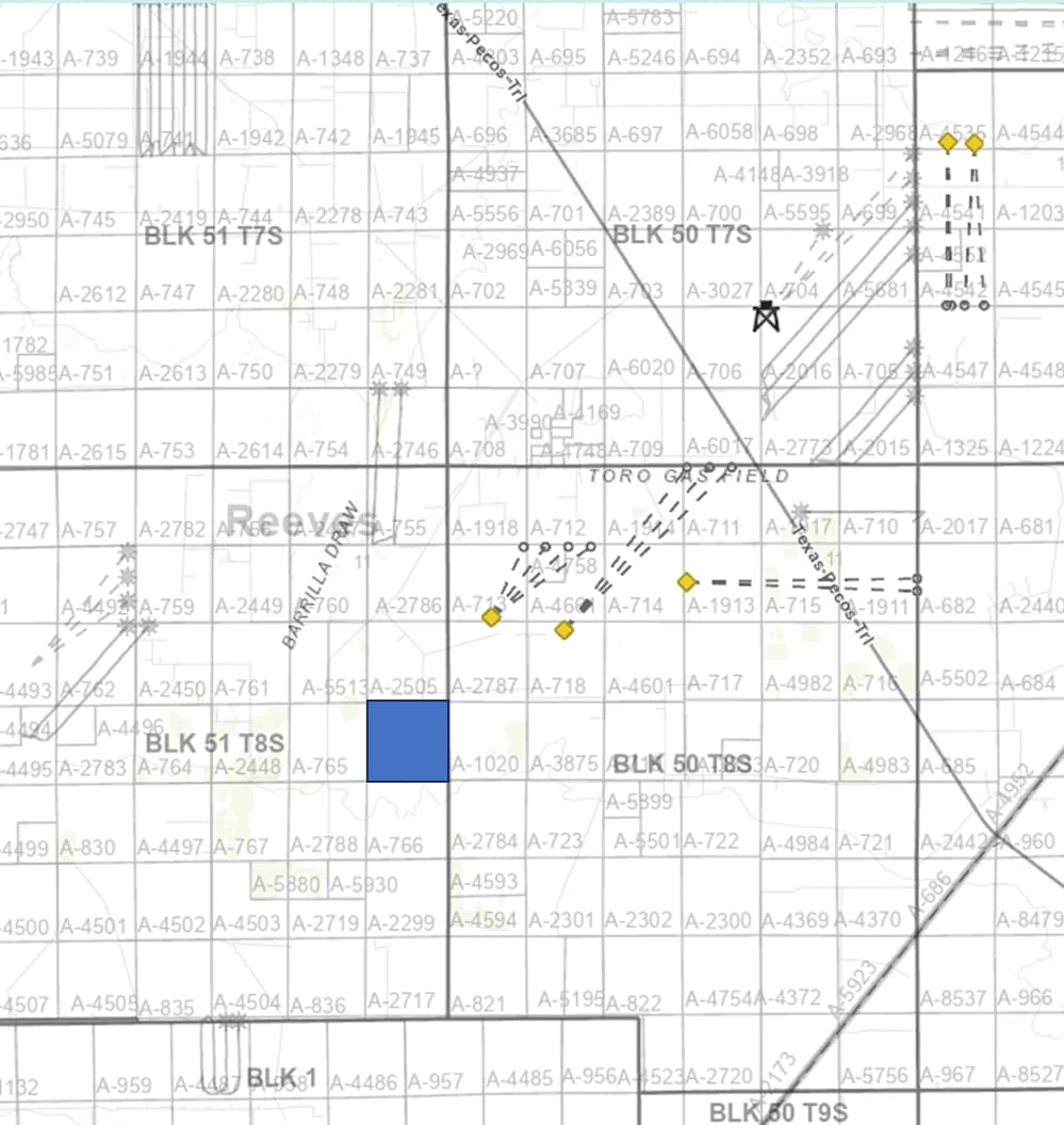
There is no drilling or permitting there. Here are wells drilled in the last 6 months and wells permitted in the last 6 months (yellow diamonds).
There are lots more wells that have been drilled (prior) that are not shown on this map, including wells directly adjacent to Section 24. It’s not the greatest area in the world, but somebody should drill the Wolfcamp there at some point if people keep drilling wells in the Permian.
---
### Author:  [@DCole](https://www.mineralrightsforum.com/u/DCole)
#### Post date: [August 20, 2023, 10:18pm UTC](https://www.mineralrightsforum.com/t/drilling-or-permitting-activity-reeves-co-tx/72001/3 "2023-08-20T22:18:25Z")
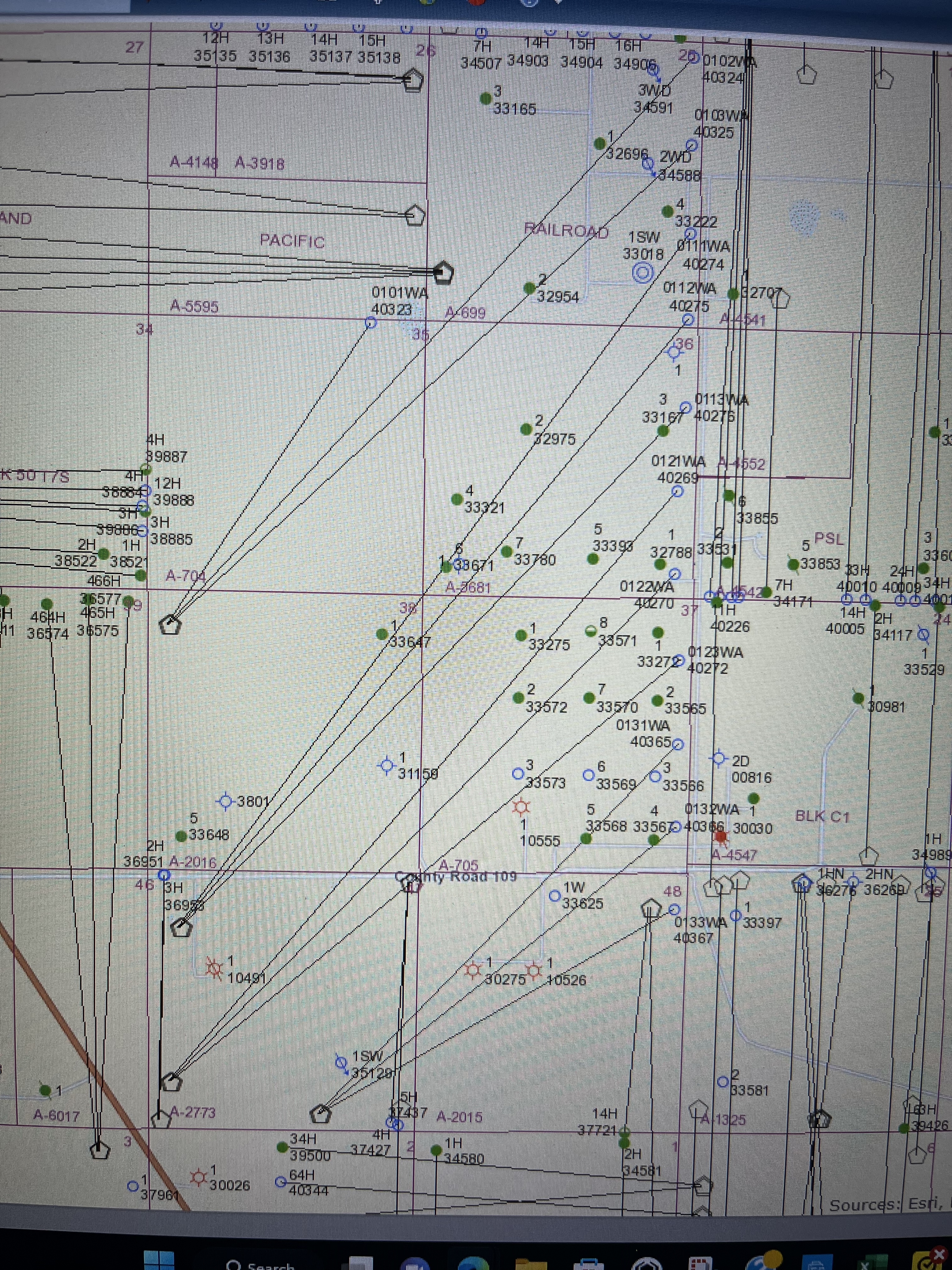
NMoilboy - Thanks for sharing the map. Does the oil rig symbol mean it is being drilled right now as it is not showing production or completion on Texas Railroad Commission website. Would like more information on the drills that start at A-2016 and A-2773
---
### Author:  [@NMoilboy](https://www.mineralrightsforum.com/u/NMoilboy)
#### Post date: [August 21, 2023, 12:24pm UTC](https://www.mineralrightsforum.com/t/drilling-or-permitting-activity-reeves-co-tx/72001/4 "2023-08-21T12:24:14Z")
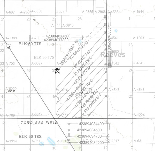
Yes, the rig symbol is the current location of Patterson 278 drilling wells for Chevron, starting in NW NW of A-2016.
They have spud all 3 of the wells your map shows on that pad, and the three wells from A-2773. Below is all the wells spud (by anyone) in this area in the last 12 months. The three wells from A-2016 don’t have public directional survey info yet, so they are just shown as dotted lines from the surface location to the proposed bottom hole location.
---
### Author:  [@ledp](https://www.mineralrightsforum.com/u/ledp)
#### Post date: [August 28, 2023, 12:52pm UTC](https://www.mineralrightsforum.com/t/drilling-or-permitting-activity-reeves-co-tx/72001/5 "2023-08-28T12:52:38Z")
The map shows block 50. My minerals are in Block 51, Township 8 South. There are 9 producers in standup 1320 in Sections 11 and 14 and three verticals in Section 24. No horizontals yet in Section 24. Also two horizontals in Section 12 all of same Block and Township.
---
### Author:  [@system](https://www.mineralrightsforum.com/u/system)
#### Post date: [November 16, 2023, 10:26am UTC](https://www.mineralrightsforum.com/t/drilling-or-permitting-activity-reeves-co-tx/72001/6 "2023-11-16T10:26:39Z")
This topic was automatically closed after 90 days. New replies are no longer allowed.