# Cypress Energy and Blue River Lease Areas
**URL:** https://www.mineralrightsforum.com/t/cypress-energy-and-blue-river-lease-areas/80448
**Category:** Houston County, TX
**Created:** [March 18, 2025, 9:29pm UTC](https://www.mineralrightsforum.com/t/cypress-energy-and-blue-river-lease-areas/80448 "2025-03-18T21:29:41Z")
**Posts on this page:** 4
**Page:** 1
### Author:  [@Alan\_Herrington](https://www.mineralrightsforum.com/u/Alan_Herrington)
#### Post date: [March 18, 2025, 9:29pm UTC](https://www.mineralrightsforum.com/t/cypress-energy-and-blue-river-lease-areas/80448/1 "2025-03-18T21:29:41Z")
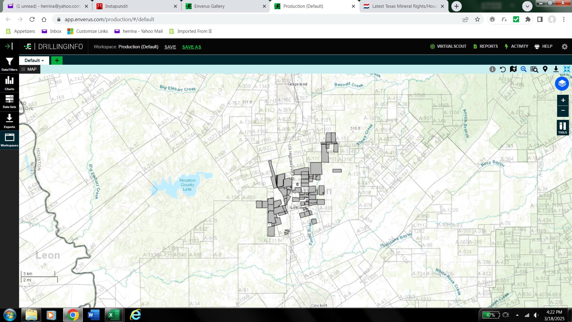
Cypress Energy has recorded leases covering almost 4,000 acres. Here is a map of the lease area, which is located between Grapeland and Crockett:
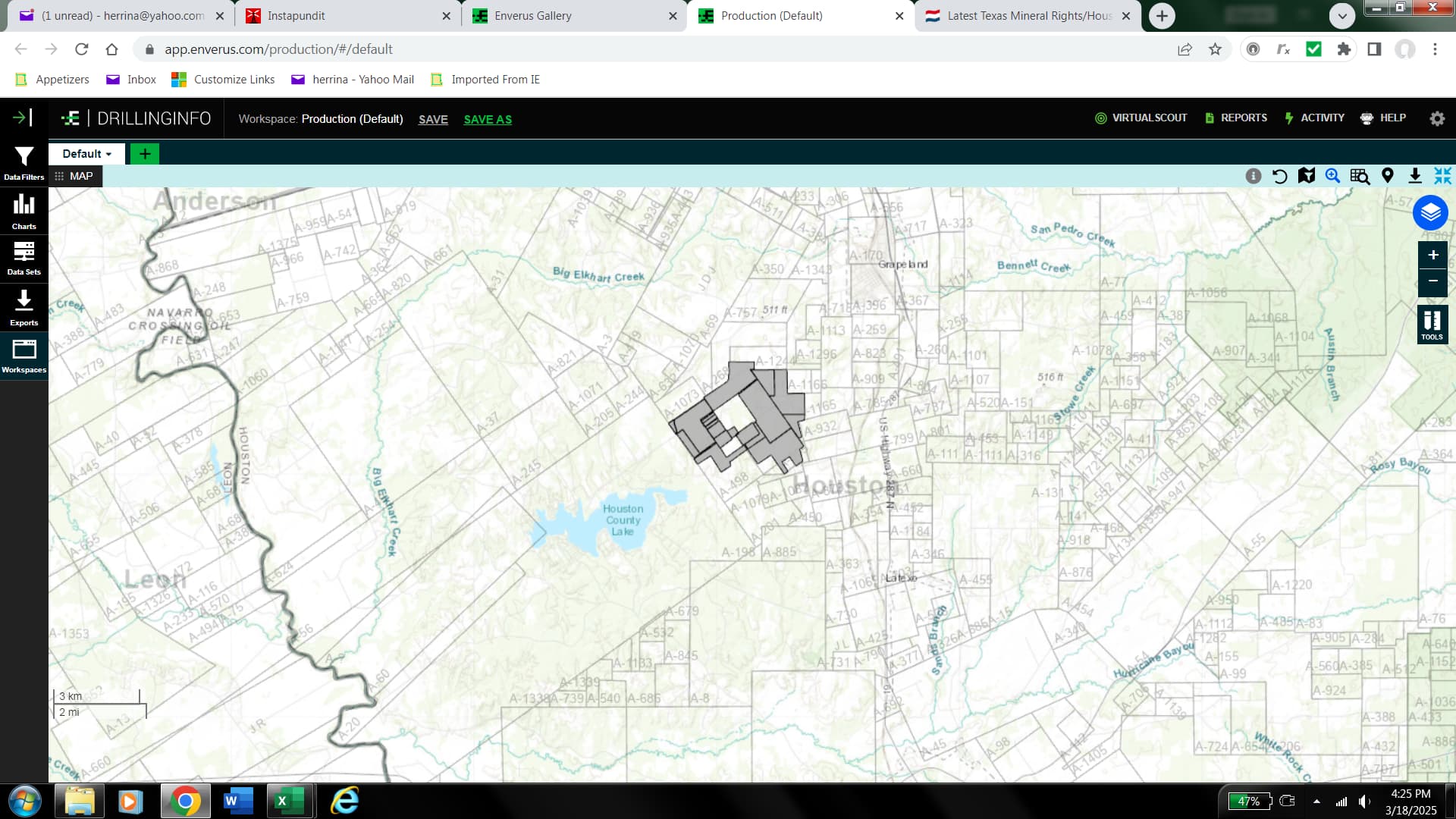
Blue River has recorded leases covering about 3,000 acres. Their lease area is also between Grapeland and Crockett, but shifted a bit to the west:
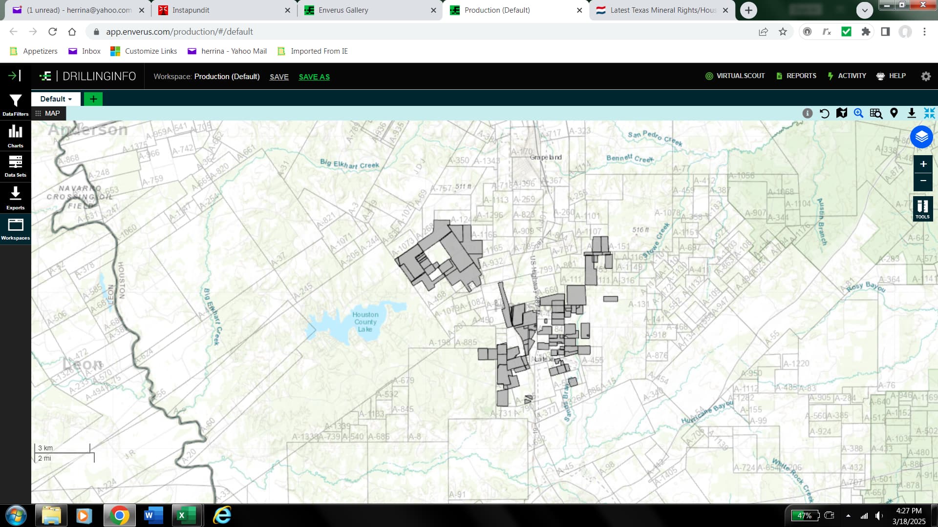
Here is a map of the combined lease areas:
Drake Exploration also is leasing in this area, but they have not recorded any leases yet.
---
### Author:  [@Alan\_Herrington](https://www.mineralrightsforum.com/u/Alan_Herrington)
#### Post date: [March 18, 2025, 9:39pm UTC](https://www.mineralrightsforum.com/t/cypress-energy-and-blue-river-lease-areas/80448/2 "2025-03-18T21:39:58Z")
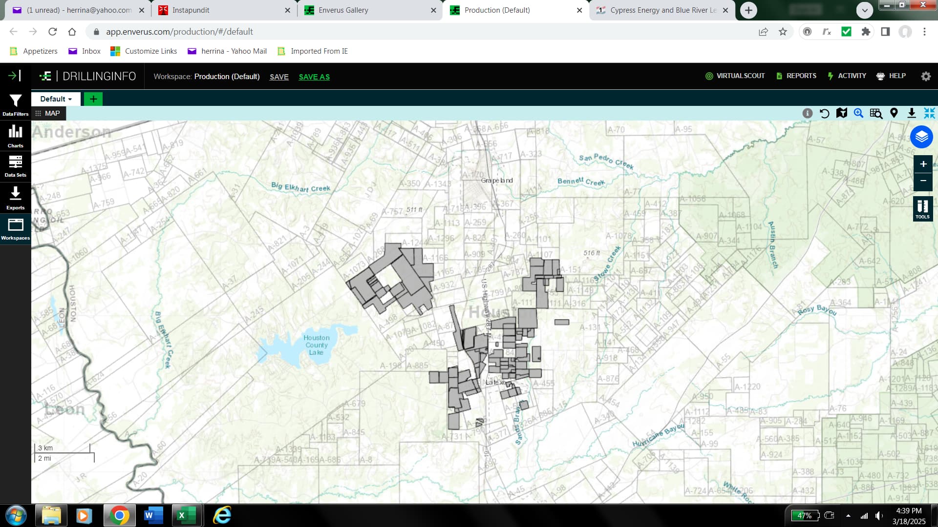
I should have included Magnetar Exploration, as they have leased about 850 acres in the same area:
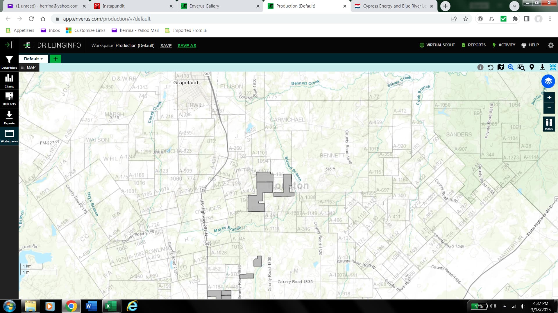
Here’s the combined map of all three leasing entities, covering about 7,850 acres:
---
### Author:  [@Mineral\_Owner5](https://www.mineralrightsforum.com/u/Mineral_Owner5)
#### Post date: [March 19, 2025, 3:32pm UTC](https://www.mineralrightsforum.com/t/cypress-energy-and-blue-river-lease-areas/80448/3 "2025-03-19T15:32:15Z")
All this area was part of the old PGS 500 Square Mile 3D shoot back prior to 2012 in the Northwest part of Houston County. These areas were where Chesapeake, Devon, Anadarko, and EOG leased along with some other smaller companies. Question: Why would 4 or so brokers be working such a small area so slowly?
---
### Author:  [@system](https://www.mineralrightsforum.com/u/system)
#### Post date: [June 17, 2025, 3:32pm UTC](https://www.mineralrightsforum.com/t/cypress-energy-and-blue-river-lease-areas/80448/4 "2025-06-17T15:32:57Z")
This topic was automatically closed 90 days after the last reply. New replies are no longer allowed.