# Current Drilling Activity
**URL:** https://www.mineralrightsforum.com/t/current-drilling-activity/56240
**Category:** Pecos County, TX
**Created:** [February 24, 2020, 3:07pm UTC](https://www.mineralrightsforum.com/t/current-drilling-activity/56240 "2020-02-24T15:07:42Z")
**Posts on this page:** 10
**Page:** 1
### Author:  [@Fletcher\_Bishop](https://www.mineralrightsforum.com/u/Fletcher_Bishop)
#### Post date: [February 24, 2020, 3:07pm UTC](https://www.mineralrightsforum.com/t/current-drilling-activity/56240/1 "2020-02-24T15:07:42Z")
Is anyone aware if there is drilling activity going on in Block 1 Sections 21, 24, or 25 on Pacos?
---
### Author:  [@fjonesiv](https://www.mineralrightsforum.com/u/fjonesiv)
#### Post date: [February 24, 2020, 3:14pm UTC](https://www.mineralrightsforum.com/t/current-drilling-activity/56240/2 "2020-02-24T15:14:47Z")
This site has a link to the [free Texas GIS mapping feature](https://www.mineralrightsforum.com/t/oil-gas-gis-maps-by-state/53539). It’s under the Directories link at the top of the page. Simply filter on your property, and you can see drilling permits. It’s free and self-serve.
---
### Author:  [@Clint\_Liles](https://www.mineralrightsforum.com/u/Clint_Liles)
#### Post date: [February 25, 2020, 3:46am UTC](https://www.mineralrightsforum.com/t/current-drilling-activity/56240/3 "2020-02-25T03:46:35Z")
PECOS COUNTY SECTIONS 21, 24, 25/BLOCK 1
Fletcher, I see no activity in this area at all.
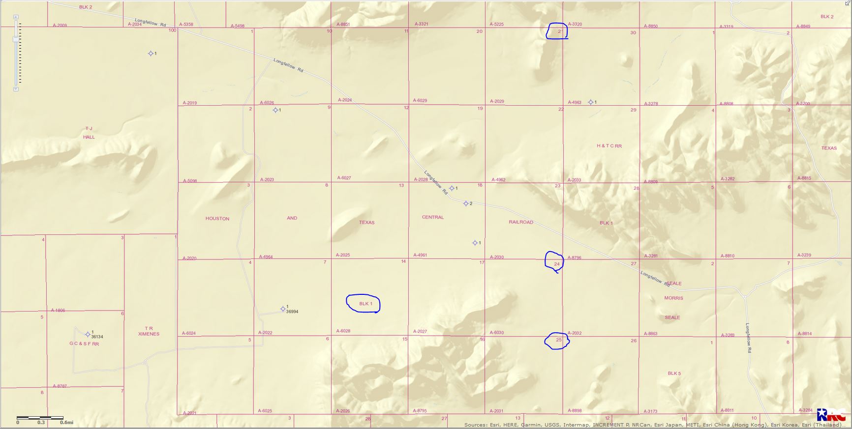
Double left click on map to enlarge.
---
### Author:  [@Rick5](https://www.mineralrightsforum.com/u/Rick5)
#### Post date: [February 25, 2020, 5:12pm UTC](https://www.mineralrightsforum.com/t/current-drilling-activity/56240/4 "2020-02-25T17:12:17Z")
XTO just sent 8 Division Orders for the Gunpowder wells. These horizontal wells comprise Sections 16 and 21, Block 48, Township 8, Texas & Pacific Railroad Company Survey. Our attorney, Mr. Flueckiger, is verifying the interest and finding out why our mineral interest was never leased in Section 16.
---
### Author:  [@NMoilboy](https://www.mineralrightsforum.com/u/NMoilboy)
#### Post date: [February 26, 2020, 5:27pm UTC](https://www.mineralrightsforum.com/t/current-drilling-activity/56240/5 "2020-02-26T17:27:37Z")
All of Section 16 has been leased since 1950. Just FYI.
Oil and Gas Lease between Ivy B. Emert, Individually and as Independent Executor of the Estate of W.W. Courtney, deceased, joined by her husband, Glen Emert, as Lessors, and F.J. Ellyson, as Lessee, dated May 5, 1950, recorded at Volume 172, Page 305, Deed Records, Pecos County, Texas. (Covering all of Sections 7, 8, 10, 16, 18, 20 and the North 3/4 of Section 28, Block 48, and all of Sections 24 and 26, Block 49, Township 8, T&P Ry. Co. Survey, Pecos County, Texas)
---
### Author:  [@Rick5](https://www.mineralrightsforum.com/u/Rick5)
#### Post date: [February 26, 2020, 7:19pm UTC](https://www.mineralrightsforum.com/t/current-drilling-activity/56240/6 "2020-02-26T19:19:49Z")
Thanks for the info NMoilboy… that would explain things as this property was not acquired until 1960.
---
### Author:  [@4556](https://www.mineralrightsforum.com/u/4556)
#### Post date: [April 8, 2020, 11:11pm UTC](https://www.mineralrightsforum.com/t/current-drilling-activity/56240/7 "2020-04-08T23:11:16Z")
Any recent drilling or interest in drilling in Pecks County, Block 1, Section 48, Township?
---
### Author:  [@Clint\_Liles](https://www.mineralrightsforum.com/u/Clint_Liles)
#### Post date: [April 9, 2020, 3:44am UTC](https://www.mineralrightsforum.com/t/current-drilling-activity/56240/8 "2020-04-09T03:44:09Z")
Pecos County Section 48/Block 1
At this time I see no activity or any production in that near area
DOUBLE LEFT CLICK ON MAP TO ENLARGE
---
### Author:  [@4556](https://www.mineralrightsforum.com/u/4556)
#### Post date: [April 9, 2020, 4:01am UTC](https://www.mineralrightsforum.com/t/current-drilling-activity/56240/9 "2020-04-09T04:01:56Z")
Had inquiry to extend lease pending upturn in economy. Thought there might be prior exploration drilling in this area. Thanks for info.
---
### Author:  [@system](https://www.mineralrightsforum.com/u/system)
#### Post date: [May 24, 2020, 3:07pm UTC](https://www.mineralrightsforum.com/t/current-drilling-activity/56240/10 "2020-05-24T15:07:46Z")
This topic was automatically closed after 90 days. New replies are no longer allowed.